
Modern warfare profoundly affects not only the population and economy of the countries involved but also their ecosystems. The war between Russia and Ukraine, ongoing since 2014, impacted an area containing Emerald Network ecological protection sites in the occupied Ukrainian regions of Donetsk and Luhansk.
The Emerald Network is a transnational network created as part of the 1979 Bern Convention on the Conservation of European Wildlife and Natural Habitats, which contributed to a two-decade-long reforestation trend in Europe as well as long-term positive forecasts compared to global forest loss.
Ukraine joined the Convention in 1996 and started implementing the associated policies, environmental protection legislation, and Emerald Network sites in 2000. Hence, analyzing changes in implementing those policies provides a unique opportunity for investigating the consequences of modern warfare on environmental sustainability and conservation.
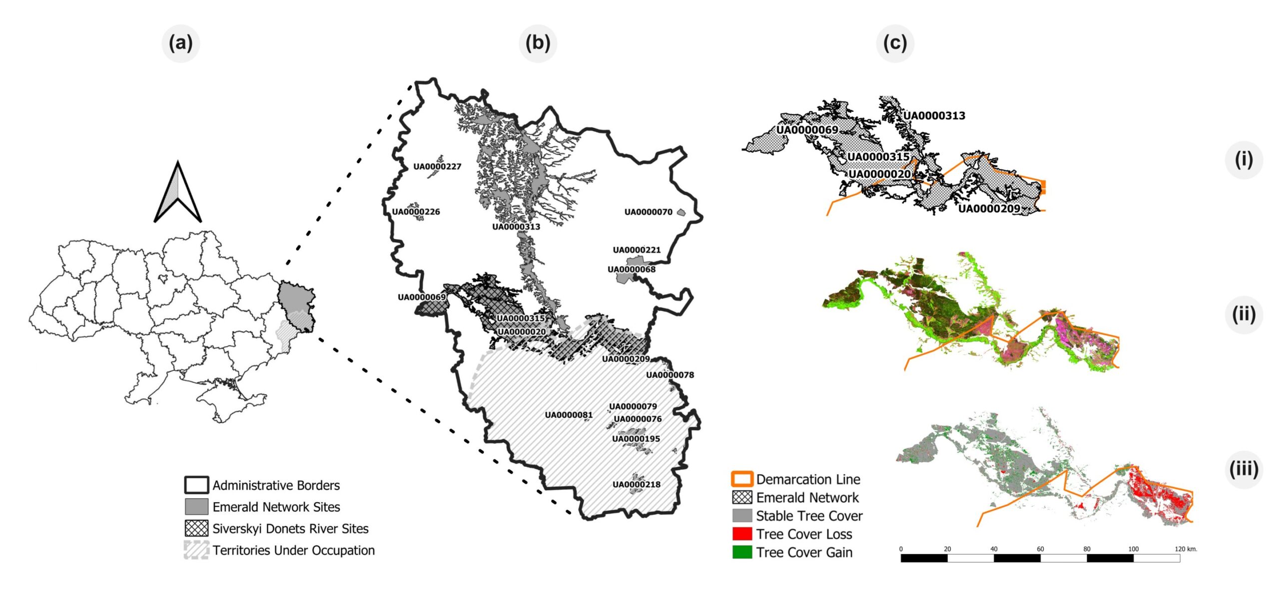
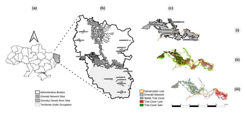
In a study published in the journal Communications Earth & Environment, researchers in Ukraine and the United States employed Landsat and Copernicus Sentinel 1 and 2 satellite imagery to analyze changes in forest cover between 1996 and 2020 in Ukraine’s Emerald Network protected areas located in the Luhansk region, under partial Russian control since 2014.
In their analysis, the group verified that between 1996 and 2000, before the creation of the Emerald Network, deforestation trends were similar in the territories currently controlled by Ukraine and Russia, with around 4% of forest loss. Additionally, from 2000 to 2013, during the Emerald Network establishment and before the conflict, reforestation rates were significant and comparable in both. (8% and 10%, respectively).
However, from 2013 to 2020, the researchers found a stark difference in conservation between the territories after the beginning of the conflict. Territories that remained under Ukrainian control gained 9% of forest area, even under military conflict and increased ecological vulnerability. On the other hand, territories under Russian control lost 20 years of sustainable development progress, with 25% of forest loss when compared to 2013 estimates.
“Our results indicate that the separation of ecosystems from environmental-protection institutions and policies through the occupation of Ukrainian territory led to dramatic degradation of the environment and loss of ecosystem sustainability,” concludes Prof. Nataliia Kussul, Head of the Department of Mathematical Modeling and Data Analysis in the National Technical University of Ukraine “Igor Sikorsky Kyiv Polytechnic Institute.”
Russia’s recent military offensive in at least eight Ukrainian regions in early 2022, including those already affected by the previous occupation, brought widespread destruction to industrial and civilian infrastructure and damage to socio-ecological systems. It also separated even more territories from conservation legislation, policies, and agreements, substantially disturbing the Emerald Network implementation process.
“We are proud that our methods of satellite intelligence, in particular forest-type classification and damage assessment models, are helping in the discovery of urgent environmental problems. It can also be applied for the identification of the forest damage in other countries and, after the war, it will be used in other affected Ukrainian regions for assessing ecosystemic damage and aiding the efforts for restoration,” says Prof. Andrii Shelestov, Lead Scientist from the Space Research Institute of National Academy of Sciences of Ukraine (SRI NASU-SSAU).
The study was developed in the context of the SWIFTT project, which aims to provide forest managers with affordable, simple, and effective remote sensing tools backed up by Copernicus satellite imagery and powerful machine learning models to detect and map the various risks to which forests are exposed such as insect outbreaks, wildfires, and windthrow.
More information:
Leonid Shumilo et al, Conservation policies and management in the Ukrainian Emerald Network have maintained reforestation rate despite the war, Communications Earth & Environment (2023). DOI: 10.1038/s43247-023-01099-4
Provided by
Da Vinci Labs
Citation:
Separated by war: Deforestation and reforestation in the Ukrainian emerald network (2023, December 11)
retrieved 11 December 2023
from https://phys.org/news/2023-12-war-deforestation-reforestation-ukrainian-emerald.html
This document is subject to copyright. Apart from any fair dealing for the purpose of private study or research, no
part may be reproduced without the written permission. The content is provided for information purposes only.


