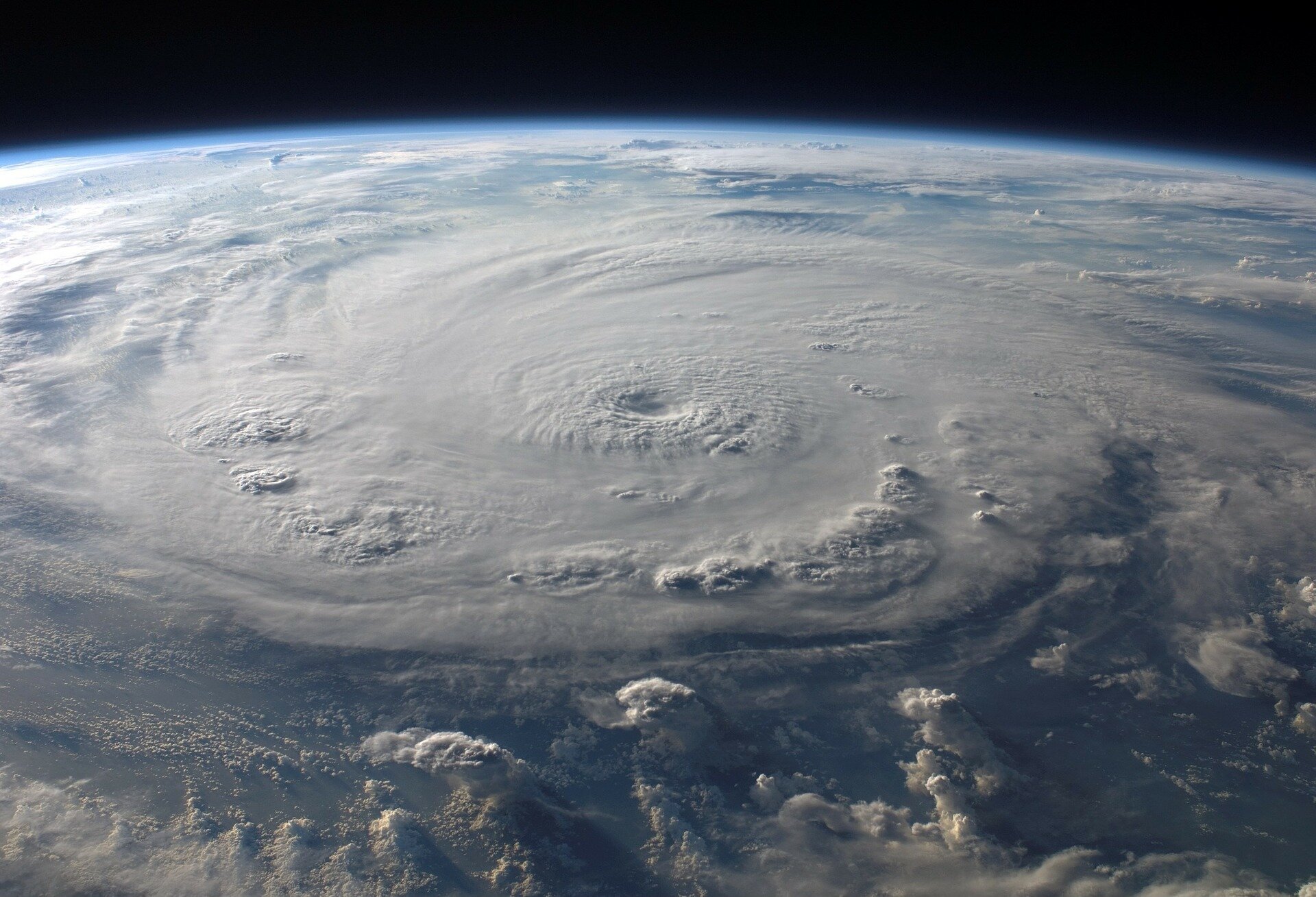

This year, a record-hot Atlantic Ocean went toe-to-toe with a strong El Niño for which weather phenomena would steer the hurricane season. The winner?
“The record-warm Atlantic came out on top,” said Phillip Klotzbach, a meteorologist and researcher at Colorado State University. “It wasn’t that the El Niño wasn’t there and didn’t have some impacts, they just didn’t extend globally like it normally does.”
Supercharged sea surface temperatures are linked with more frequent and more intense storm activity, and the global weather phenomenon El Niño often brings a chill to the Atlantic Ocean that slows down storm formation.
The collision of these two major factors in 2023 was unprecedented, forecasters said. By meteorological measures, the hot Atlantic won out, based on the number and longevity of storms this active season. But by practical measures, at least for those of us in South Florida, El Niño did help steer most storms away from landfall.
And as the six-month storm window officially draws to a close on Thursday, it marks the end of another above-average hurricane season, as predicted in August by NOAA and others. Earlier in the year, experts predicted a below-average season, but then the Atlantic started heating up.
The final tally is 20 named storms, seven of which were hurricanes and three of which were major hurricanes, Category 3 or higher. An average season has 14 named storms.
Only one hurricane made landfall in the U.S. this year, Category 3 Hurricane Idalia. It hurtled into Florida’s Big Bend region on August 30, bringing up to 12 feet of storm surge and flooding rain, yet a very low death toll. Officials credited a speedy and effective evacuation response, as well as the “luck factor” of Idalia coming ashore in one of Florida’s least populated corners.
The U.S. also saw two landfalling tropical storms, Harold in Texas on August 22 and Ophelia in North Carolina on September 23.
This was also the first year since 2014 that South Florida didn’t fall under any “cone of uncertainty” for a tropical storm or hurricane.
“It was one for the books,” Klotzbach said, “but overall a benign season.”
El Niño’s (limited) impact
In a normal El Niño year, there are usually fewer storms, mostly because the changing global weather pattern increases the amount of storm-shredding wind shear in the Atlantic.
Ryan Truchelut, chief meteorologist of private weather service Weather Tiger, said that wind shear is a result of the difference in temperature between the Pacific and Atlantic Ocean. But this year, they were both so hot that there wasn’t much of a difference at all.
“Without that temperature contrast, if the Atlantic is very, very warm and the Pacific is warm, it just doesn’t drive those unfavorable winds in the same way,” he said.
That’s also why this year’s Accumulated Cyclone Energy, a meteorologic metric that accounts for how powerful a storm is and how many days it spends churning in the Atlantic, was much higher than other El Niño years.
An average El Niño year has about 50 ACE units, Truchelut said. In 2023, the Atlantic accrued 146 ACE units, making this year the most active season ever during a moderate or strong El Niño.
However, El Niño did help steer many of the Atlantic storms that formed this season away from the east coast. Sixteen of the season’s 20 storms all stayed well east of the U.S. and Caribbean, thanks to “a protective trough of low pressure” along the Atlantic seaboard, Truchelut said.
But the clear winner of this season’s match-up was the Atlantic, which warmed faster than ever before and stayed hot for longer than usual. This record-breaking heat made storm formation easier, in addition to cooking hundreds of corals to death in reefs throughout the Caribbean.
The clearest culprit for this unseasonably hot water was another big player in the Atlantic hurricane season: the trade winds.
These wind currents sweep from one end of the Atlantic to the other, cooling down the sea surface and churning up cooler, deeper water that slows down storm formation and strengthening. But this year, Klotzbach said, they were weaker than normal.
“The trade winds basically collapsed. You just didn’t have that evaporation you normally get,” he said. “The fact that it was so persistent was unusual.”
It’s not clear why these winds were weak this year. Some scientists have suggested the hotter-than-average ocean is a symptom of the world reaching a “tipping point” from climate change, which is warming the world and changing how and when hurricanes form and get stronger. But Klotzbach said he thinks weather, the day-to-day changes in temperature and rain, might be more to blame than longer-term climate trends.
“Climate change loads the dice for these extreme events, but when you have these monster outliers, then it’s not climate change per se, but it’s weather that would make such a big change over a short time frame,” he said. “When you see big changes over a few months, it’s not like we tripled CO2 in the span of two months, that’s weather.”
He and Truchelut are working on a new scientific paper exploring what caused the Atlantic to boil this year, and how climate change may have played a role.
What about next season?
While it’s too early to make any concrete predictions about what 2024’s hurricane season could bring, it’s clear the table will be set a little differently.
Strong El Niños like this one rarely last through the winter, meteorologists say. NOAA pegs the chances of this one dissolving by the summer at 75%. It could be replaced by the opposite global weather phenomena, La Niña, which tilts the scales toward more storms, or the middle balance between the two, known as ENSO neutral.
The hot water, on the other hand, may stick around.
“To me, the bigger question is are these ridiculously warm waters in the Atlantic going to persist, or is that going to change over the winter? We really can’t say,” Klotzbach said. “There’s a lot of time between now and April.”
Truchelut, on the other hand, is a little more confident that the Atlantic will stay warmer than usual, at least through the spring. Earlier warm water like that is linked to an earlier start to the hurricane season, which research by Truchelut and Klotzbach suggests is due to climate change.
“Going forward, the odds are skewed in the direction of a pretty active year after a strong El Niño,” he said.
It might be a few years before another El Niño occurs in the Atlantic, but Truchelut said this season’s takeaway is that the traditional protective benefits of the weather pattern may be lessening as the world warms.
“It’s alarming to me that you can’t count on El Niño to reliably reduce hurricane risk. We’ve learned that is subject to external factors that can override it,” he said. “The rules may no longer apply, unfortunately.”
©2023 Miami Herald. Distributed by Tribune Content Agency, LLC.
Citation:
El Niño helped steer storms away from U.S. this hurricane season. What about next year? (2023, December 3)
retrieved 3 December 2023
from https://phys.org/news/2023-12-el-nio-storms-hurricane-season.html
This document is subject to copyright. Apart from any fair dealing for the purpose of private study or research, no
part may be reproduced without the written permission. The content is provided for information purposes only.


